 |
 |
 |
 |
Ayrshire
|
 |
Illustrated Catalogue of |
Ayrshire Milestones |
Copyright notice: Links to this site are welcomed. However none of the material on the site may be duplicated in any form. The copyright of the articles is the property of the authors. The copyright of photographs and images is the property of David McClure, unless otherwise attributed. Copyright of the web pages is the property of David McClure. |
|
|||||
Description |
A719 from Ayr to Galston. Its continuation from Galston towards Strathaven, omitted from the description of Turnpike 10 in the 1827 Act, is part of Turnpike 14. |
||||
In the Road Acts |
1767:
The road leading from Ayr to Galston, towards Strathaven, so far
as that road is within the said county of Ayr. |
||||
MS Summary |
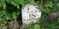
Ayr 1, 4, 5 (off road). Also a direction stone at the junction with T31 (B739) and another at the junction with T18. Milestones marked on OS Landranger at NS453315, NS462325, and NS 478351 were not found. |
||||
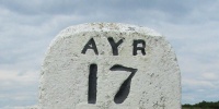
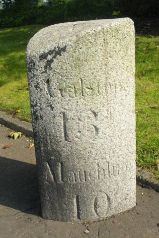
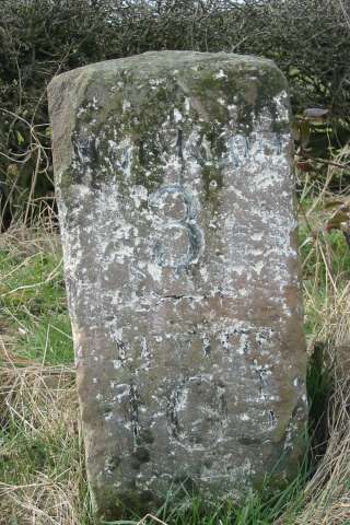
Ayr 1. Galston 13½, Mauchline 10. Height 65cm. On S side of road. On Whitletts Road at entrance to Tesco. This section of road was shared by T10 and T12. Photos DMcC 8th August 2004. |
 |
 |
|||
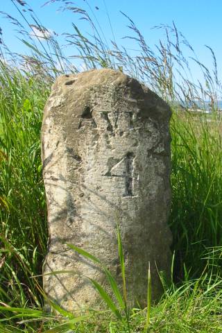
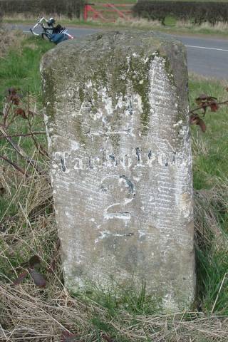
Ayr 4. Tarbolton 3¼, Galston 10½. Height 59cm. On S side of road. On A719 E of Sandyford Toll. Photos DMcC 24th June 2004. |
 |
 |
|||
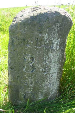
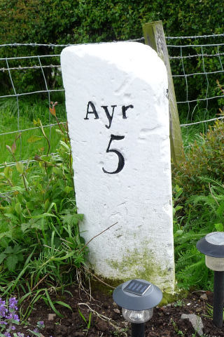
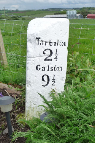
Ayr 5. Tarbolton 2¼, Galston 9½. In domestic garden at Springbank, not far from original roadside location.
Photos DMcC 18th May 2009. |
 |
 |
|||
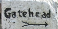
Ayr, arrow L, no distance; Tarbolton 2, arrow R. Monkton 3, Irvine 10½. Height not measured. At junction of T10 and T31 (B739); on N side of T10 and W side of T31.
Photos DMcC 17th March 2003. |
 |
 |
|||
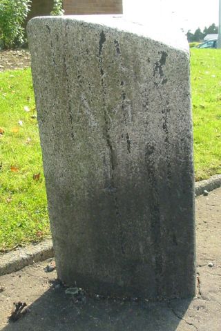
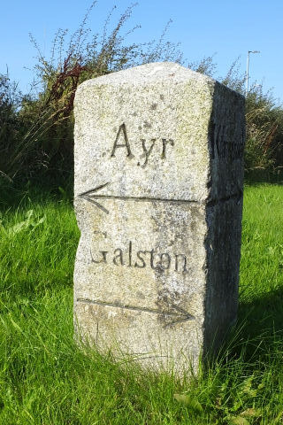
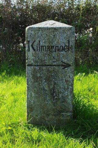
Ayr, Galston. Kilmarnock, Mauchline (indistinct), Cumnock (indistinct).
This marks the intersection of Turnpike 10 with Turnpike 18 (leading from Kilmarnock, by Mauchline, to Old Cumnock). That is, the intersection of A719 and A76.
This direction stone is at the south-west corner.
Photos DMcC 30th September 2015. |
 |
 |
|||
|
|||||