 |
 |
 |
 |
Ayrshire
|
 |
Illustrated Catalogue of |
Ayrshire Milestones |
Copyright notice: Links to this site are welcomed. However none of the material on the site may be duplicated in any form. The copyright of the articles is the property of the authors. The copyright of photographs and images is the property of David McClure, unless otherwise attributed. Copyright of the web pages is the property of David McClure. |
|
|||||
Description |
The A79 from Ayr to Prestwick. The road is bisected here by Prestwick Airport. It continued to Monkton on the other side of the airport. From Ayr to Monkton it shared the line with Turnpike 1 (Ayr to Irvine). From Monkton it continues on a minor road towards Kilmarnock, then the A77(T), and the B7038 into Kilmarnock. |
||||
In the Road Acts |
1767:
The road from Ayr to Kilmarnock. |
||||
MS Summary |
Ayr 2, 3, 5, 10, 11. Ayr 2 and 3 are common to Turnpikes 1 and 2. There is also one stone in the collection on the Montgreenan Estate which came from this road, and which is described and illustrated in its proper sequence below. |
||||
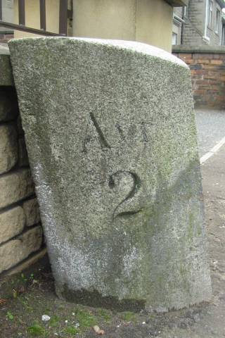
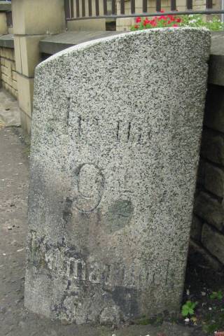
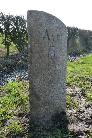
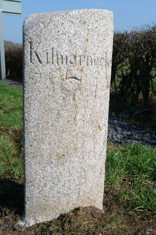
Ayr 2. Irvine 9½, Kilmarnock 10. Height 58cm. On E side of road. Photos DMcC 27th August 2004. |
 |
 |
|||
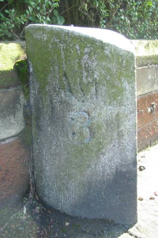
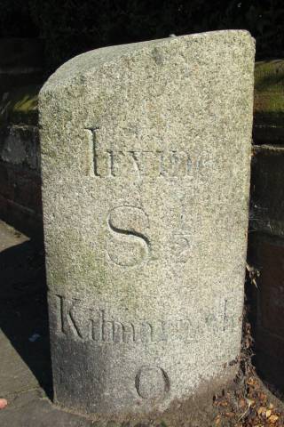
Ayr 3. Irvine 8½, Kilmarnock 9. Height 62cm. On E side of road. Photos DMcC 27th August 2004. |
 |
 |
|||
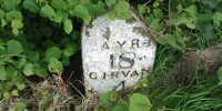
Ayr 5. Kilmarnock 7. On SE side pf dual carriageway between Brocket Farm and the roundabout. Photos DMcC 18th March 2009.
|
 |
 |
|||
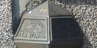
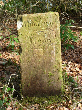
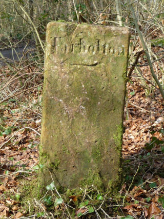
Kilmarnock , Troon Tarbolton
This direction stone is no longer on the road, but in the collection described in 'The Montgreenan Milestones' (Ayrshire Notes 46). The original location was at the junction of T2 (the road from Ayr to Kilmarnock) and T24 (the road leading from Irvine, by Stair Bridge, to Dalmellington); in modern terms this is on the B730 at the junction with the A77, prior to the construction of a flyover. According to the 1 st OS there was a guidepost' at this junction, and this stone is a guide or direction stone with no distances. See also The Montgreenan Milestones.
Photos: DC McClure, March 2009. |
 |
 |
|||
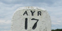
Ayr 10. Kilmarnock 2. Height (by long inclined side) 51cm. On E side of road. Hidden in a hawthorn hedge opposite MGM Garden & Leisure. Photos DMcC 28th August 2004. |
 |
 |
|||
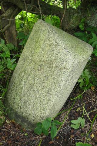
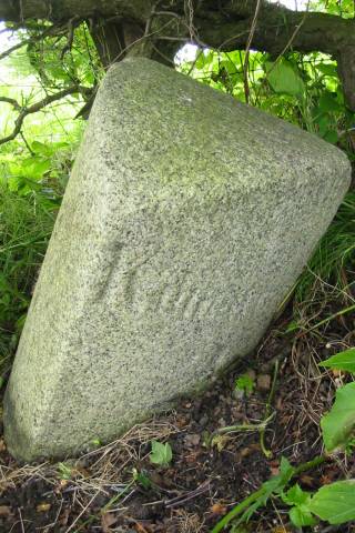
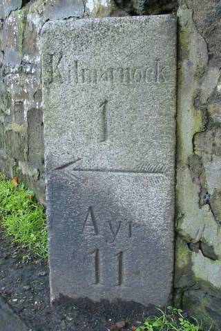
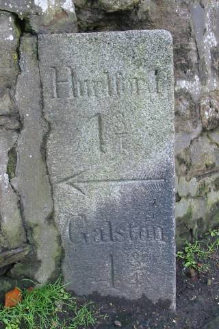
Kilmarnock 1, Ayr 11. Hurlford 1¾, Galston 4¾. Height 73cm. On E side of turnpike 2 and S side of turnpike 14. This square section stone is set into the wall of the graveyard of Riccarton Parish Church, at the junction of Old Street and New Street, with two adjacent faces visible. There must be an arrow for Ayr below ground level. Photos DMcC 26th October 2004. |
 |
 |
|||
|
|||||