 |
 |
 |
 |
Ayrshire
|
 |
Illustrated Catalogue of |
Ayrshire Milestones |
Copyright notice: Links to this site are welcomed. However none of the material on the site may be duplicated in any form. The copyright of the articles is the property of the authors. The copyright of photographs and images is the property of David McClure, unless otherwise attributed. Copyright of the web pages is the property of David McClure. |
|
|||||
Description |
Now incomplete, though much of the original line can be traced on the OS maps and on the ground. It shared the line south of Irvine with T1 (now A737) till it forked E at NS325371 towards Drybridge. It can be followed on foot or bicycle across the bypass (A78) and then by minor road to the B730 at Drybridge. The B730 follows the line of T24 SE through Dundonald, Tarbolton, and Drongan to Littlemill. The original line continued up through the later village of Rankinston and across the hills to Dalmellington. Afforestation and open-cast mining have obliterated much of its course. The later T76 runs SW from Littlemill to join the Ayr to Dalmellington turnpike (T38, now A713) near Polnessan. |
||||
In the Road Acts |
1767: The road leading from Irvine,
by Stair Bridge, to Dalmellington.
Note that this turnpike intended to connect Dalmellington with Irvine is in the 1767 Act, whereas the turnpike between Dalmellington and Ayr was in the 1774 Act. This probably reflected the relative importance of the two ports at the time. The prospect of transporting coal to the more important port of Irvine probably led to the priority given to the turnpike to Irvine. |
||||
MS Summary |
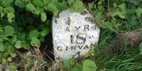
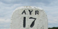
Irvine 7, 8¾ miles 1 furlong 44 yards, 12, 13, 15, 16, 20. There are also 5 direction stones along the route, included in sequence below. Additionally there are five stones from this road in the collection at Montgreenan, and these have been included in their proper place below: Irvine 2, 3, 4, 4¾; and a direction stone between Irvine 7 and 8. |
||||
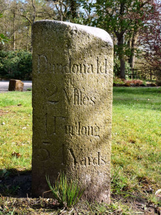
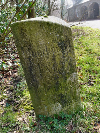
Dundonald 3 miles 4 furlongs 54 yards. Irvine 2.
Photos: DC McClure, March 2009.
This is one of the stones at Montgreenan. |
 |
 |
|||
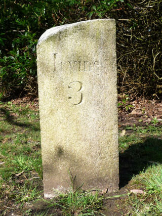
Dundonald 2 miles 1 furlong 54 yarfs, Irvine 3.
Photos: DC McClure, March 2009.
This is one of the stones at Montgreenan.
|
 |
 |
|||
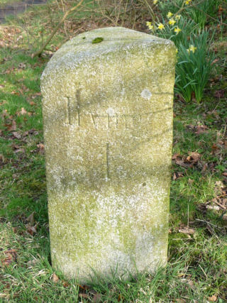
Dundonald 1 mile 1 furlong 54 yards. Irvine 4.
Photos: DC McClure, March 2009.
This is one of the stones at Montgreenan. |
 |
 |
|||
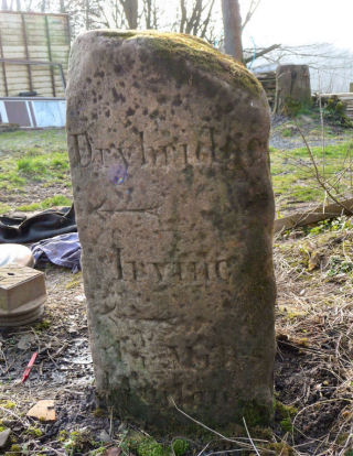
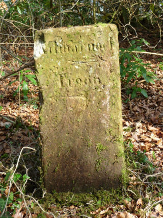
Drybridge L Irvine L 4¾ miles 1 furlong. Kilmarnock 5 R Dundonald ¼ L , Troon.
Photos: DC McClure, March 2009.
This is one of the stones at Montgreenan.
|
 |
 |
|||
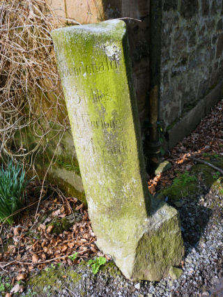
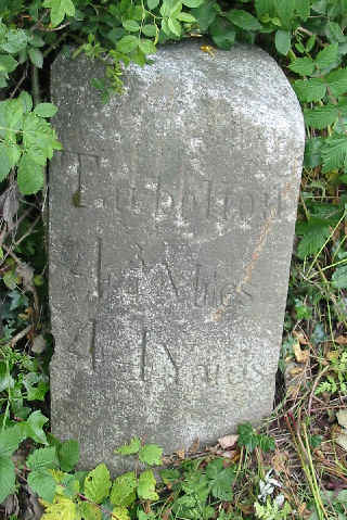
Tarbolton 4¾ miles 44 yards. Irvine 7. Height 66 cm. On NE side of road. This milestone lies between Dankeith and Coodham, near Symington. Milestones with such precise measurements occur elsewhere in what became the Kilmarnock roads district.
Photos DMcC 20th June 2003. |
 |
 |
|||
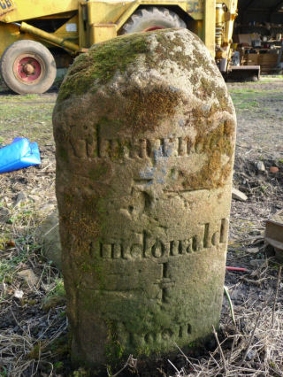
LH face: Kilmarnock R Troon L RH face: Tarbolton L
Photos: DC McClure, March 2009.
This is one of the stones at Montgreenan.
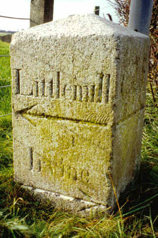
The original location was at the junction of R1/T2 and R16/T24; in modern terms this is on the B730 at the junction with the A77. According to the 1st OS there was a guidepost’ at this junction, and this stone is a guide or direction stone with no distances. Bogend turnpike or toll was also located at this junction, which is still known as Bogend Toll. Apart from the effects of road-widening, the junction is in its historic position, but a major improvement scheme is now in hand. |
 |
 |
|||
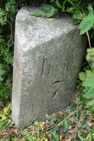
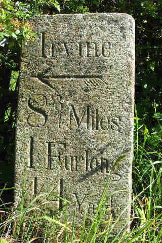
Irvine 8¾ miles 1 furlong 44 yards Height 68 cm. On the NE corner of a junction with a minor road to Craigie. At NS 412310.
Photo DMcC 25th June 2004. |
 |
||||
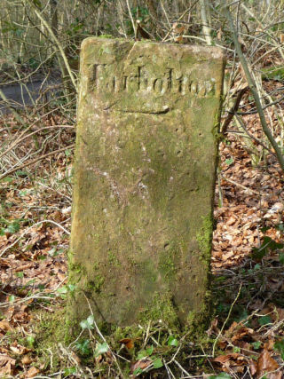
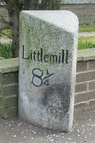
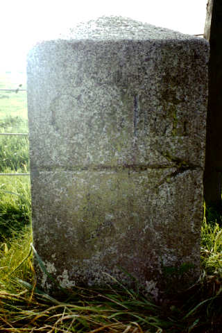
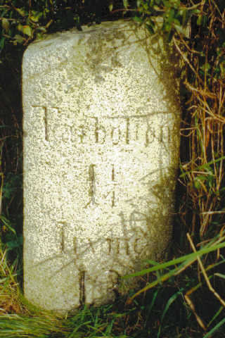
Littlemill 8¼. Irvine 12. Height [to be measured]. On the E side of the road at the S extremity of the village of Tarbolton.
Photos DMcC 17th March 2003. |
 |
 |
|||
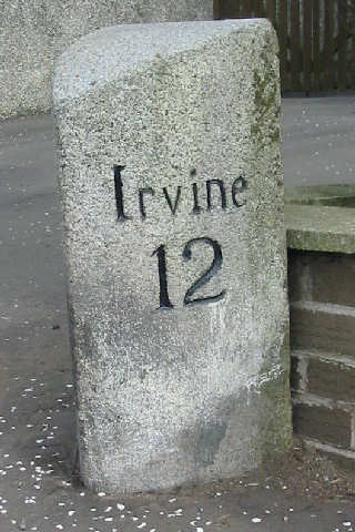
Littlemill; Irvine. Coylton. Height [to be measured]. On the SW corner of the B730/B744 junction at the S extremity of the village of Tarbolton, close to the Irvine 12 milestone. NS432268.
Photos DMcC October 1992. |
 |
 |
|||
Stair; Tarbolton. Height [not measured]. This direction stone, shown here in October 1992, is now missing. There is a large mound of earth at this corner. This is at the NE corner of the B730/B743 junction, at Carngillan. NS431256.
Photos DMcC October 1992 and 5th July 2004. |
 |
||||
 |
|||||
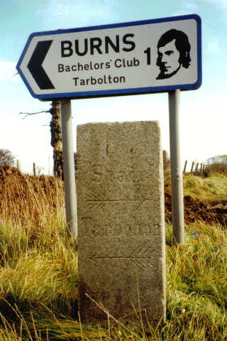
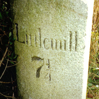
Littlemill 7¼. Tarbolton 1¼, Irvine 13. Height [not measured].
Photos DMcC October 1992. |
 |
 |
|||
|
|||||
