 |
 |
 |
 |
Ayrshire
|
 |
Illustrated Catalogue of |
Ayrshire Milestones |
Copyright notice: Links to this site are welcomed. However none of the material on the site may be duplicated in any form. The copyright of the articles is the property of the authors. The copyright of photographs and images is the property of David McClure, unless otherwise attributed. Copyright of the web pages is the property of David McClure. |
|
|||||
Description |
The line has been taken roughly by A78T, except where this bypasses town centres. Thus it follows A737 from Irvine to Kilwinning and thence towards Stevenston, where it joins A78T. Then A738 into Saltcoats, B714 round by South Bay, rejoining A738 through Ardrossan and so back to A78T. The 'cut [c]' in the 1827 Act is now B7047 north into West Kilbride, B781 north, where this turns east continuing north on a minor road to rejoin A78T at North Kilrusken. |
||||
In the Roads Acts |
1767: The road from Irvine to Saltcoats [Turnpike 4]. 1767: The road leading from Saltcoats, by Largs, to Kelly Bridge [Turnpike 23. Note that Kelly Bridge is the boundary between Ayrshire and Renfrewshire]. In the 1805 and subsequent acts the two were combined referred
to here as Turnpike 4. |
||||
MS Summary |
One milepost in Boglemart Street, Stevenson. One milestone in Nineyards Street, Saltcoats. Neither are shown on OS Landranger sheet 70 (1:50,000). |
||||
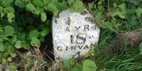
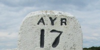
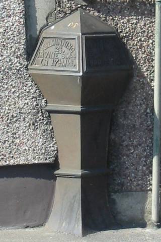
Kilwinning 2¾, Irvine 6, Ayr 17½. Saltcoats 1, Ardrossan 2½, Largs 14. Height [not measured]. On N side of Boglemart Street, Stevenston (A738). Grid ref. NS264419. Photos DMcC 19th April 2003. |
 |
 |
|||
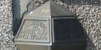
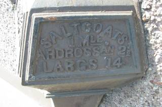
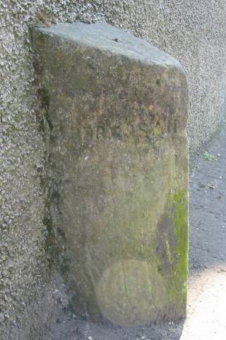
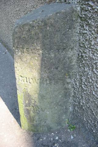
Ardrossan. Stevenston, Kilwinning. No distances visible. Height [not measured]. On E side of Nineyards Street, Saltcoats (B714), close to the railway bridge. Grid ref. NS248412. Photos DMcC 19th April 2003. |
 |
 |
|||
|
|||||