 |
 |
 |
 |
Ayrshire
|
 |
Illustrated Catalogue of |
Ayrshire Milestones |
Copyright notice: Links to this site are welcomed. However none of the material on the site may be duplicated in any form. The copyright of the articles is the property of the authors. The copyright of photographs and images is the property of David McClure, unless otherwise attributed. Copyright of the web pages is the property of David McClure. |
|
|||||
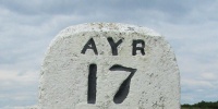
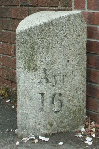
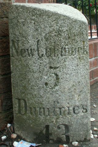
Ayr 16. New Cumnock 5, Dumfries 43. Height 62cm. On E side of road. Once again in this and the following three milestones the termini reflect the continuity of the turnpike, which was the road from Ayr to Dumfries, and not the continuity of the A76, which is the road from Dumfries to Kilmarnock. Photos DMcC 2nd June 2005.
Note: I had overlooked this milestone, despite cycling along the road. Jim Johnstone pointed out the omission in April 2005. Thank you Jim. |
 |
 |
|||
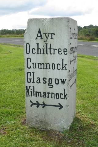
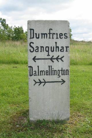
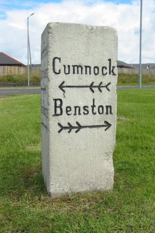
The direction stone below was at the fork where T68 left T9 south-east of Cumnock. This is now where the A76 bypassing Cumnock rejoins the old line, and the direction stone is in an approximation of its original position. See below the images for further information. |
|||||
 |
 |
 |
|||
Above: The direction stone was on the narrow angle of the fork. This face lay approximately along the line of T9, and pointed north-west. Ayr, Ochiltree, and Cumnock were on T9, which terminated in Ayr. Glasgow and Kilmarnock were alternative destinations from Cumnock. Photo DMcC 30 August 2004. |
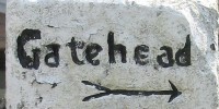
Above: This face was the one seen by a traveller coming south-east along the T9 from Cumnock. Left led along the T9 to Sanquhar and Dumfries (the present A76). Right led along T68 (now a minor road) to meet the T39 which led from New Cumnock to Dalmellington. Photo DMcC 30 August 2004. |
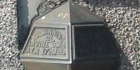
Above: This face lay approximately along the line of T68. Left led north-west along the T9 to Cumnock etc. Right led along the T68 to Benston and the T39. Benston is just a farm now, but it was the site of an important lime quarry. Photo DMcC 30 August 2004. |
|||
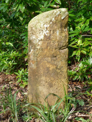
An earlier stone from this location is one of The Montgreenan Milestones.
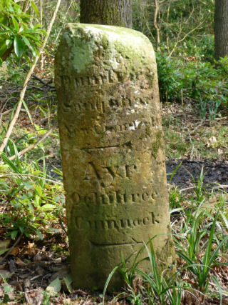
Photos: DC McClure, March 2009.
The destinations on the badly-worn right-hand face could be Dalmellington (to the right) and Cumnock (to the left). The milestone was located at the junction near Skerrington of T9 leading from Cumnock towards Sanquhar (the present A76) with T68, leading by way of Benston limework to join T39, the road from New Cumnock to Dalmellington (the present B741). No milestone or guide post is shown at the point on the 1st OS. |
 |
 |
|||
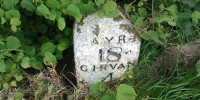
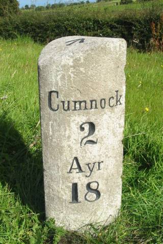
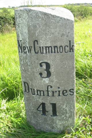
Cumnock 2, Ayr 18. New Cumnock 3, Dumfries 41. Height 87cm. On E side of road. Photos DMcC 30 August 2004. |
 |
 |
|||
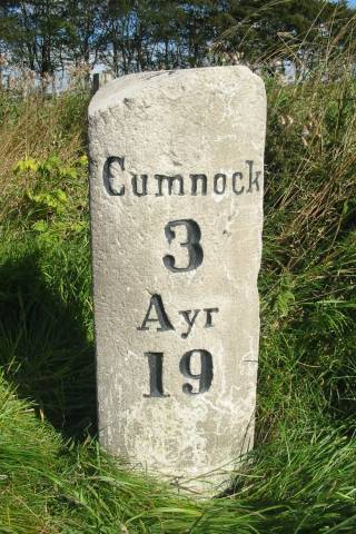
Cumnock 3, Ayr 19. New Cumnock 2, Dumfries 40. Height 91cm. On E side of road. This milestone is a comparative rarity, in that although it is on an 'A' road, it is not marked on the OS Landranger, but it exists and is in its proper position. Photos DMcC 30 August 2004. |
 |
 |
|||
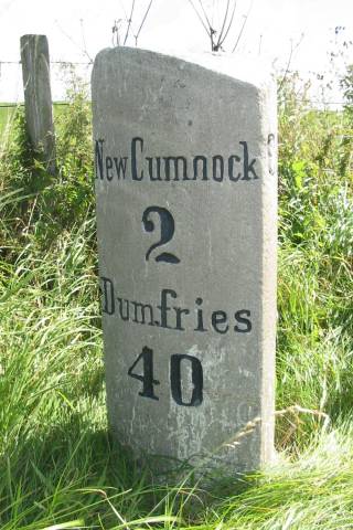
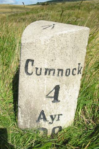
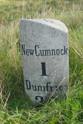
Cumnock 4, Ayr 20. New Cumnock 1, Dumfries 39. Height 68cm. On E side of road. This milestone is planted too deep for the distances to Ayr and Dumfries to be completely visible. Photos DMcC 30 August 2004. |
 |
 |
|||
There are no other milestones found on T9 (A76) between 'Ayr 20' and the county line south-east of New Cumnock. |
|||||
|
|||||

