 |
 |
 |
 |
Ayrshire
|
 |
Illustrated Catalogue of |
Ayrshire Milestones |
Copyright notice: Links to this site are welcomed. However none of the material on the site may be duplicated in any form. The copyright of the articles is the property of the authors. The copyright of photographs and images is the property of David McClure, unless otherwise attributed. Copyright of the web pages is the property of David McClure. |
|
|||||
Description |
B7073 through Hurlford, then joining A76 as far as the B7083 and following that through Auchinleck to Old Cumnock. |
||||
In the Road Acts |
|
||||
MS Summary |
Kilmarnock 1, 2, 7, 8, 9, 13, and 6 direction stones. |
||||
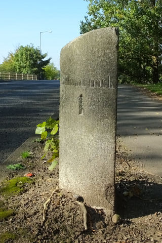
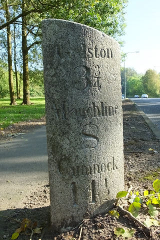
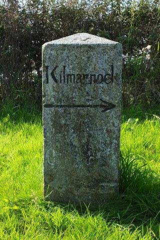
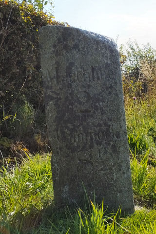
Kilmarnock 1. Galston 3¾, Mauchline 8, Cumnock 14½. On the north side of B7073, just before the bridge across the A77. This stone also serves Turnpike14 (the road from Kilmarnock to Galston).
Photos DMcC 30th September 2015. |
 |
 |
|||
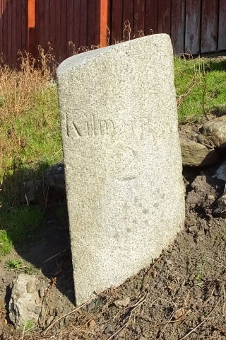
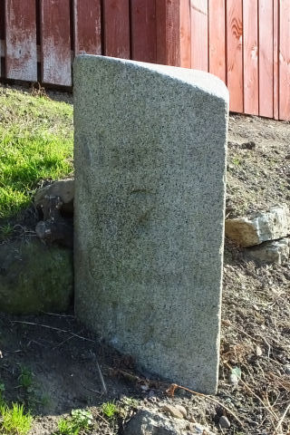
Kilmarnock 2. Mauchline 7, Cumnock 13½. On the east side of B7073, opposite a former church and close to Cessnock Road.
Photos DMcC 30th September 2015. |
 |
 |
|||
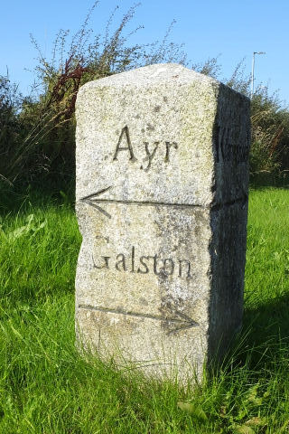
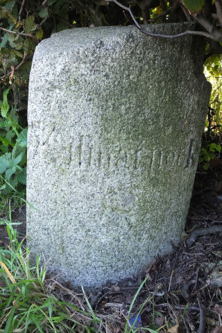
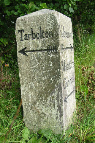
Kilmarnock, Mauchline (indistinct), Cumnock (indistinct). Ayr, Galston.
This marks the intersection of Turnpike 18 with Turnpike 10 (the road leading from Ayr to Galston, towards Strathaven, so far as that road is within the said county of Ayr). That is, the intersection of A76 and A719.
This direction stone is at the south-west corner.
Photos DMcC 30th September 2015.
|
 |
 |
|||
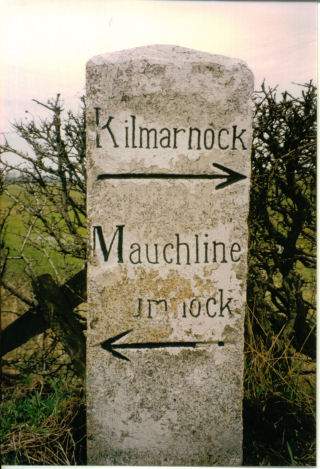
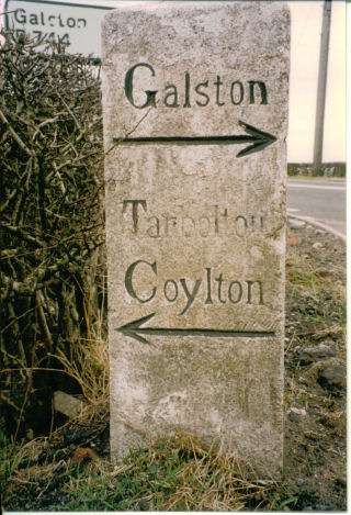
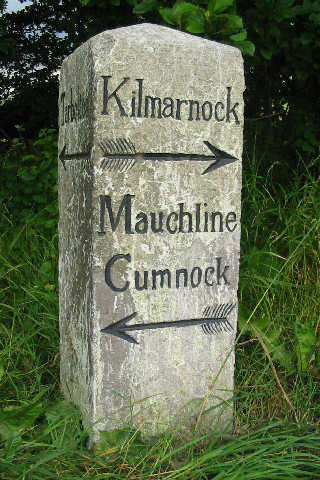
Kilmarnock, Mauchline, Cumnock. Galston, Tarbolton, Coylton. This direction stone is at the intersection of Turnpike 18 and Turnpike 13 ( The road from the said village of Mauchline to Galston). That is, the intersection of A76 and B744.
Photos DMcC. Date to be established but 1990s. |
 |
 |
|||
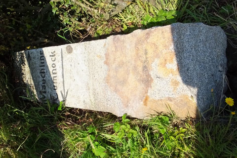
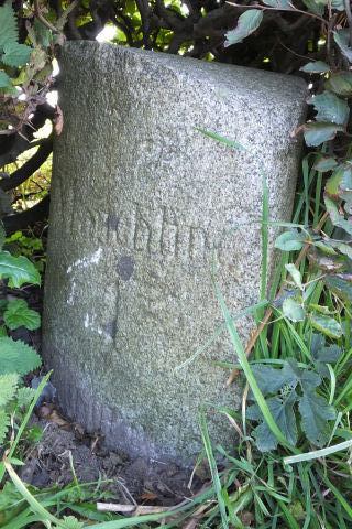
Photo DMcC 30th September 2015. The stone had been uprooted recently. |
 |
||||
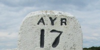
Kilmarnock 7. Mauchline 2, Cumnock 8½.
Photos DMcC 30th September 2015. |
 |
 |
|||
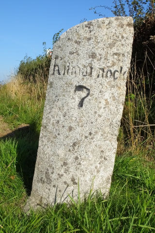
Kilmarnock 8. Mauchline 1, [Cumnock 7½].
Photos DMcC 30th September 2015. |
 |
 |
|||
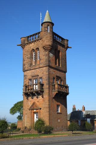
The National Burns Memorial is near to the 'Mauchline 1' milestone and the junction at which it stands is the proper site of the misplaced direction stone described below.
Photo DMcC 30th September 2015.
|
 |
||||
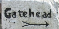
This direction stone should be at the fork in the road where where T18 meets T29 (the road from Mauchline by Millburn to Craigie Castle) which at this point is leading in the direction of Tarbolton. The National Burns Memorial is at this junction. This direction stone is actually situated on west side of the straight stretch of Turnpike 18 about 1 mile south of Mauchline Cross.
Photos DMcC 28th July 2004. |
 |
 |
|||
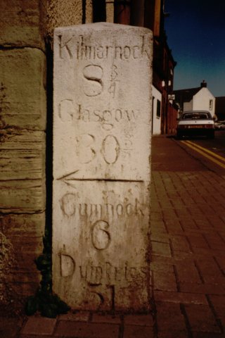
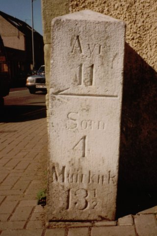
Ayr 11; Sorn 4, Muirkirk 13½. Kilmarnock 8¾, Glasgow 30¾; Cumnock 6, Dumfries 51. Indicating distances on both T12 and T18. Height not measured. On NE corner of The Cross,Mauchline. This stone has since been refurbished and resited - see below.
Photos DMcC August 1993. |
 |
 |
|||
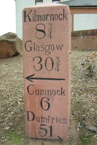
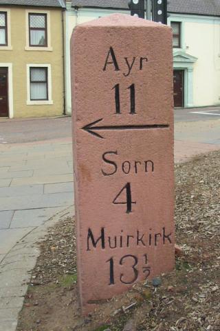
The above stone refurbished and in its new position at The Cross, Mauchline - on the E side of T18 (A76) and facing T12 (B743). Height 109cm.
Photos DMcC 28th July 2004. |
 |
 |
|||
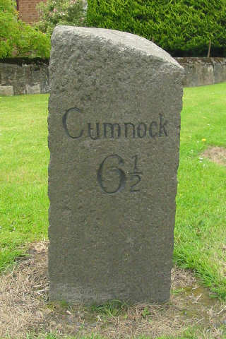
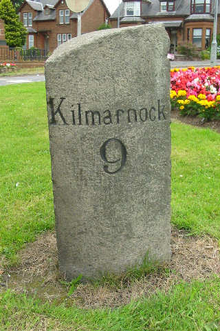
Cumnock 6½ Kilmarnock 9. This milestone stands at the junction where the road to Catrine leaves the road to Cumnock. The direction stone described below should be at this same junction.
Photos DMcC 28th July 2004. |
 |
 |
|||
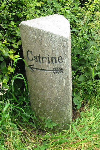
This direction stone should be at the junction of Turnpike 18 (leading from Kilmarnock, by Mauchline, to Old Cumnock) with Turnpike 74 ( from the south end of Mauchline village, by Grassmillees and Ballamyle Smithy to Catrine, and from thence towards Sorn, by the back of the Chapel of Ease, passing through the parishes of Sorn and Mauchline ) in Mauchline. This direction stone is actually situated on east side of the straight stretch of Turnpike 18 about 1 mile south of Mauchline Cross.
Photos DMcC 28th July 2004. |
 |
 |
|||
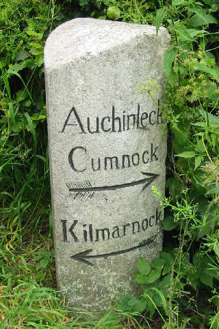
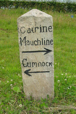
Catrine, Mauchline (north-west on T18) Cumnock (south-east on T18 Ochiltree (south-west on T80).
This direction stone sits where Turnpike 18 (leading from Kilmarnock, by Mauchline, to Old Cumnock ) meets Turnpike 80 (from Ochiltree by the aforesaid ford [at Loganston], and from thence by Blackfallhead, Drumfork and Brackenhill, where it joins the road from Mauchline to Cumnock, passing through the parishes of Ochiltree and Auchinleck).
Photos DMcC 28th July 2004. |
 |
 |
|||
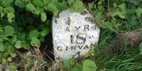
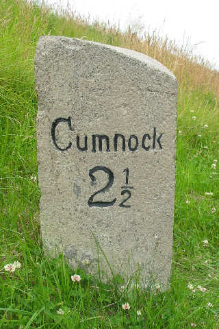
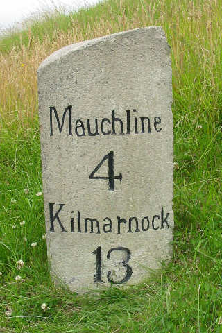
Cumnock 2½ Mauchline 4, Kilmarnock 13
Photos DMcC 28th July 2004. |
 |
 |
|||
|
|||||
